3D modeling
3D Modeling
Geolink provides high-resolution static modeling services, offering a level of depth and model complexity tailored to your needs.
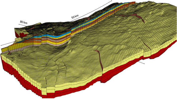
The orthogonal nature of the JewelGrid (JewelSuite solution in use) is well suited to reservoir modeling, and improves the geometric representation of geological features, reservoir simulation results, and drilling target positioning. It is interoperable with other software.
We pay particular attention to interpreting and integrating the most relevant data upstream in order to innovatively populate vertical and lateral heterogeneity by applying various conditioning techniques to our rock property modeling
Workflow
- Data integration
- 3D grid construction details with fault model
- Facies model
- Rock property modeling
- Fluid model
- Volumetric calculations
- Multi-scenario modeling and/or sensitivity analysis to simulate and compare different geological configurations and risk parameters, thereby reducing uncertainty and improving decision-making. Parametric uncertainties can be applied to input parameters in various workflows throughout the application