
Geolink – Integrated Sequence Stratigraphy Consulting
Decades of Expertise, Delivering Clarity for
the Natural Resources Industry
Since 1996, Geolink has been supporting energy companies and the broader natural resources sector with industry-leading consultancy in integrated seismic analysis and sequence stratigraphy.
With extensive multidisciplinary expertise, we provide exploration and carbon storage projects with cutting-edge insights and valuable regional knowledge, particularly across the Norwegian Continental Shelf.
Exploration projects often face costly uncertainties and missed reservoir opportunities. Geolink’s rigorous, data‑driven approach transforms complex subsurface information into clear, actionable insights that help reduce risk and minimize unforeseen costs, allowing you to move forward with confidence.
Why Partner with Geolink?
Proven Expertise: More than 25 years of experience supporting leading petroleum operators.
Fully Integrated Approach: Seamlessly combining geological, geophysical, and petrophysical knowledge.
Regional Advantage: In‑depth understanding of key offshore basins, with a particular focus on the Norwegian Continental Shelf.
Why Industry Leaders Trust Geolink:
International recognition since 1996.
Strong regional expertise with deep knowledge of the Norwegian Continental Shelf.
A transparent, collaborative approach, ensuring no hidden costs or unexpected outcomes
Ready to gain a competitive edge in exploration and carbon capture?
Contact Geolink’s team now or call +33 (0) 476 444 975 to discuss your project needs.
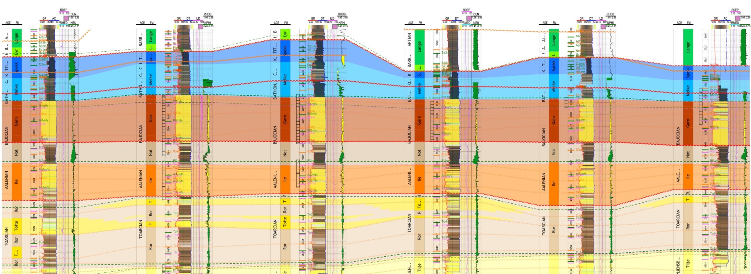
Well data integration & analysis
Sequence stratigraphic interpretation of logs, well and biostratigraphic datasets
Detailed correlation panels highlighting facies relationships
Petrophysics
Porosity, permeability, water saturation, clay volume, Net to Gross calculation
All integrated within a robust sequence stratigraphic framework
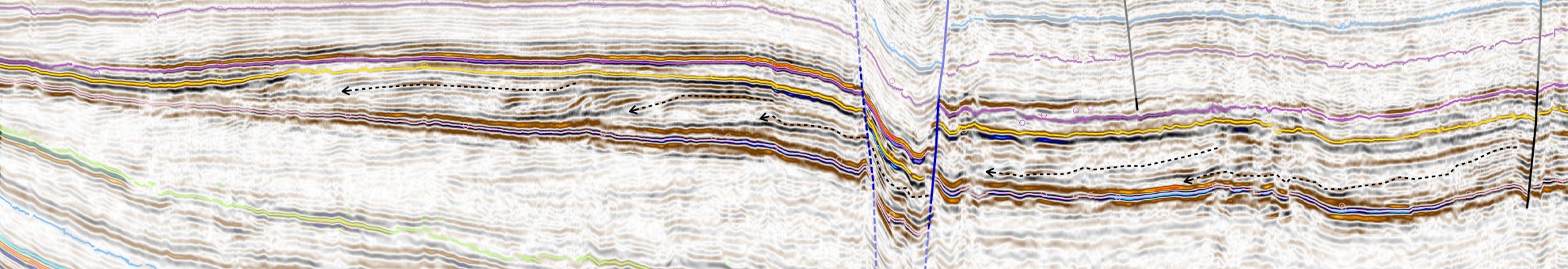
2D & 3D seisimic interpretation
Data analysis, regional mapping, and seismic facies classification
Interpretation using industry-standard platforms (KingdomSuite®)
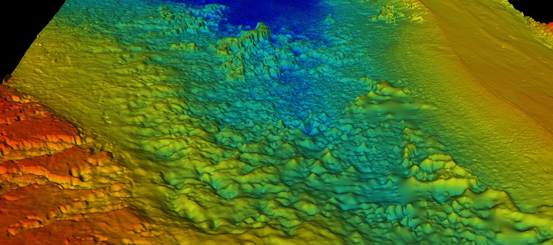
Paleogeography reconstruction
2D and 3D depositional models tracing feeding systems and environment changes through time
Paleogeographic mapping to visualize depositional environments and inform exploration
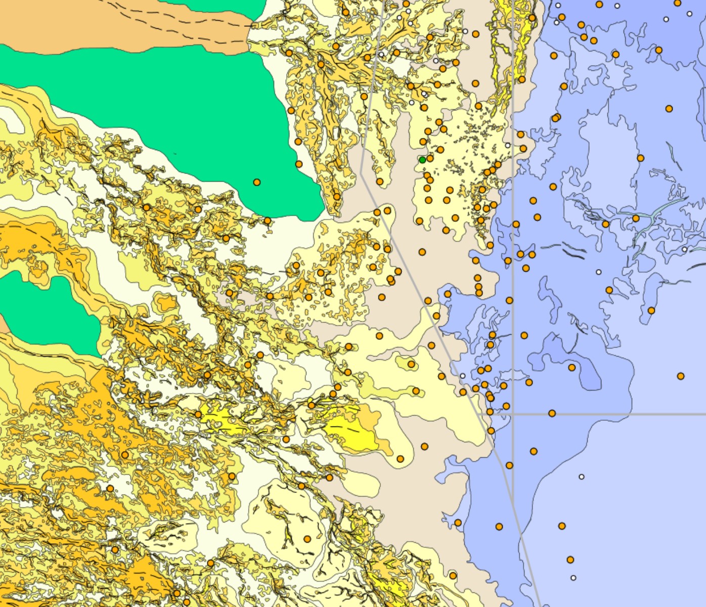
3D seisimic reservoir delineation & analysis
Predict reservoir boundary and property distribution
High-resolution depositional environment mapping anchored by well and seismic data
3D Modeling
Building complex reservoir models for visualization, simulation, calculation & assessment