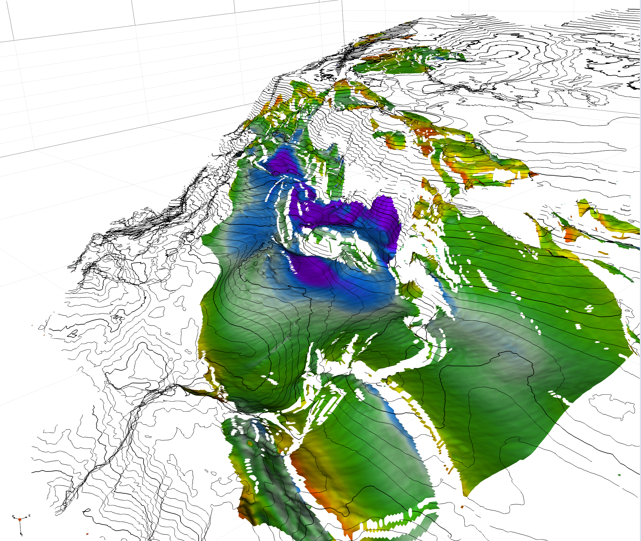
Norwegian Sea
multi-clients projects
Cretaceous of Halten and Dønna Terrace
Cretaceous Reservoir Mapping Project
This project delivers a high‑resolution seismic mapping of key Cretaceous depositional events. By combining well data, biostratigraphy, and advanced 3D seismic interpretation, we provide a clear stratigraphic framework for the Halten and Dønna Terraces.
What it covers
Area: From the eastern pinch‑out of the Cretaceous succession to the Sklinna Ridge–Klakk Fault Complex in the west.
Focus: Identification of potential sandstone reservoirs within the Lange and Lysing formations.
Results: 13 ready‑to‑use interpreted surfaces, detailed maps of reservoir intervals, fault networks, and amplitude attributes.
Value
The study highlights prospective Cenomanian–Coniacian intervals and delivers ready‑to‑load seismic grids and maps, offering exploration teams a reliable basis for reservoir evaluation and decision‑making.
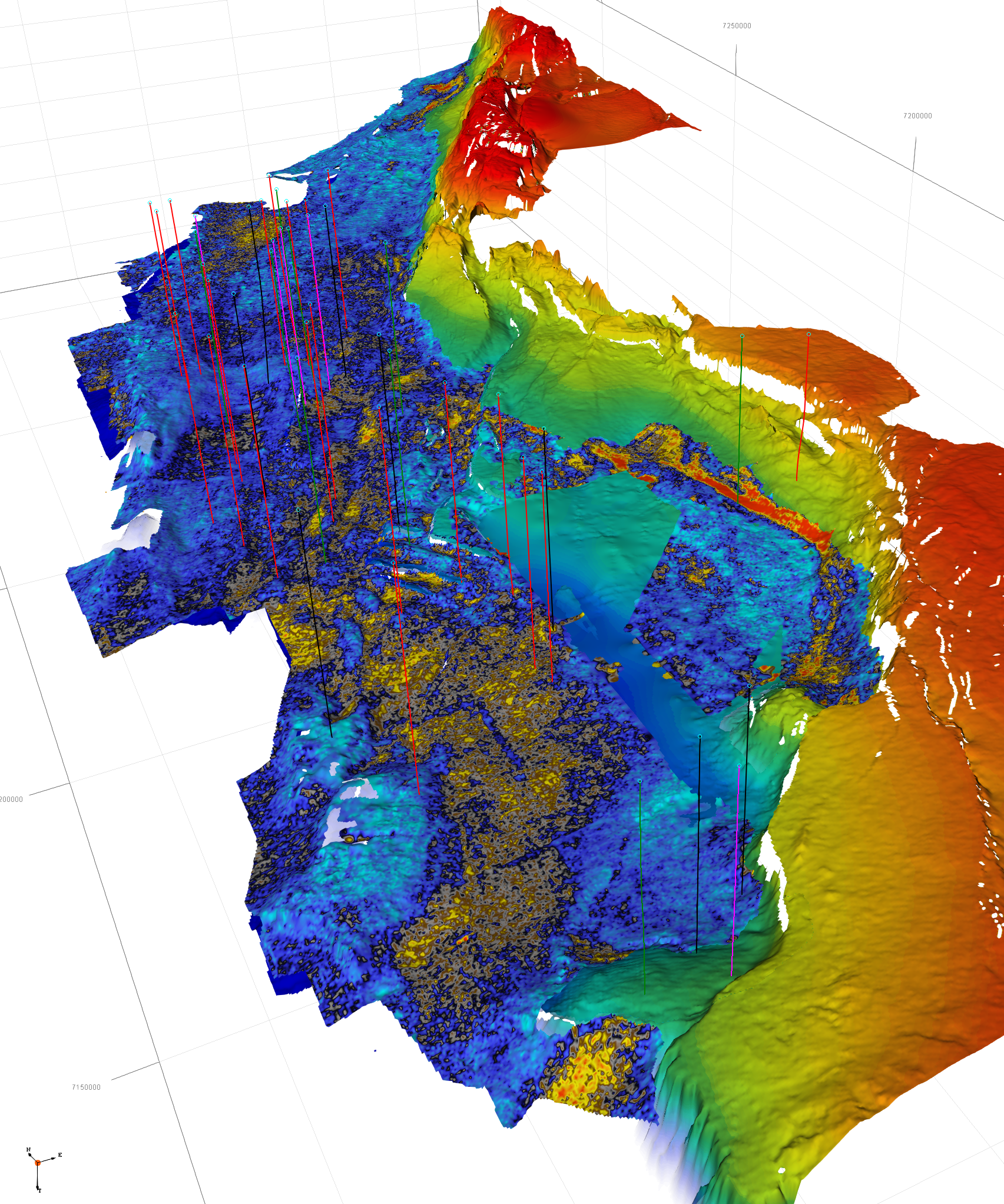
Triassic/Jurassic of Trøndelag Platform, Froan Basin and Helgeland Basin
Project Description
This project focuses on integrating well and biostratigraphic data into a seismic stratigraphic framework to map major Triassic and Jurassic depositional events.
Regional Coverage
From the Frøya High in the south to the Nordland Ridge in the north, and from the Dønna and Halten Terraces in the west to the eastern pinch‑out of the Jurassic succession, our study offers a complete regional perspective on this geologically complex area.
Objectives
The objective is to generate structural and isochron maps that illustrate the geological evolution of the Trøndelag Platform and the Helgeland Basin over time. This work highlights key structural processes, including the formation of accommodation space in the Helgeland Basin, erosion zones in the Nordland Ridge and Frøya High, and their influence on sediment supply, transport pathways, and facies distribution within the Jurassic succession of the Norwegian Sea.
Deliverables
14 fully interpreted regional grids, from the base Triassic salt to the Base Cretaceous Unconformity (BCU)
Seamless integration of 2D seismic data (with 3D support locally)
Fault polygons and detailed onlap/toplap interpretations for advanced stratigraphic analysis
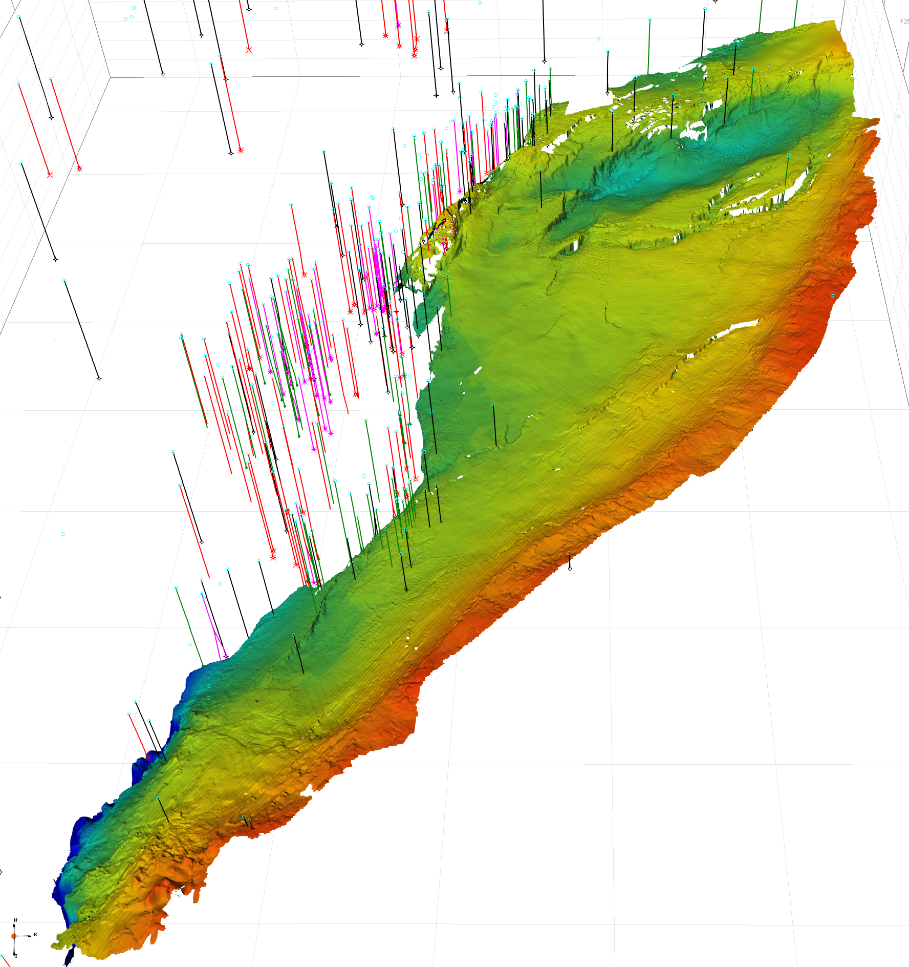
Triassic/Jurassic of Halten Terrace
Project Description
Seismic mapping of key Triassic and Jurassic depositional events, calibrated with well data and biostratigraphic information, has been integrated into a seismic stratigraphic framework.
Regional Coverage
The project focuses on the Halten Terrace, bordered by the Bermstein Fault Complex and the Trøndelag Platform to the east, the Vingleia Fault Complex to the south, the Sklinna Ridge to the west, and the Dønna Terrace to the north.
Objectives
The goal is to generate structural and isochron maps to visualize the geological evolution of the Halten Terrace and the Sklinna Ridge through time. The study emphasizes the structural processes that create accommodation spaces, such as the Gimsan Basin and Ellingråsa Graben, and erosional zones acting as sediment sources, such as the Sklinna Ridge and Frøya High. These structural controls influence the orientation, distribution, and facies variations of Jurassic sedimentary deposits in the Norwegian Sea.
Deliverables
12 ready‑to‑use grids, covering the full interval from base Triassic salt to the Base Cretaceous Unconformity (BCU).
High‑resolution seismic grids (3D‑based, partial coverage) enriched with fault polygons, onlap and toplap delineations.
Actionable datasets designed to support exploration workflows, risk assessment, and prospect evaluation.
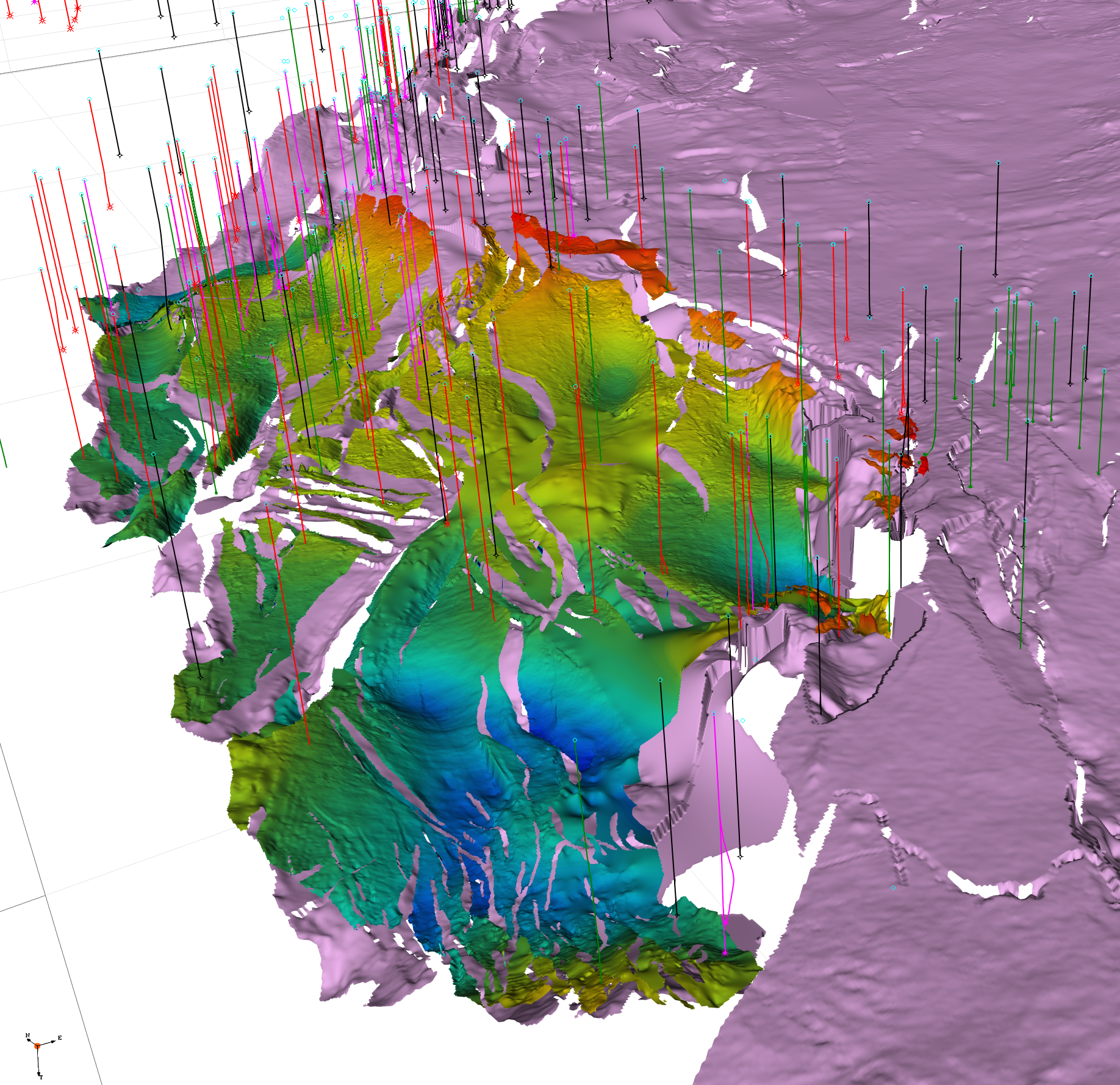
Triassic/Jurassic of Dønna Terrace, Sør High, Rødøy High, Nordland Ridge
Project Description
Seismic mapping of key Triassic and Jurassic depositional events, calibrated with well data and biostratigraphic information, has been integrated into a seismic stratigraphic framework.
Regional Coverage
Dønna Terrace and Nordland Ridge.
Objectives
The study covers the Dønna Terrace and Nordland Ridge, aiming to generate structural and isochron maps to illustrate their geological evolution over time. The results highlight structural processes that create accommodation space and erosion zones—such as those associated with the Sør High and Rødøy High—and how these features influence sediment routing, depositional patterns, and facies variations within the Jurassic succession of the Norwegian Sea
Deliverables
10 interpreted grids from Base Triassic Salt to BCU
High-resolution surfaces from 3D seismic data (with partial coverage)
Fault polygons, onlap, and toplap lines prepared for direct integration