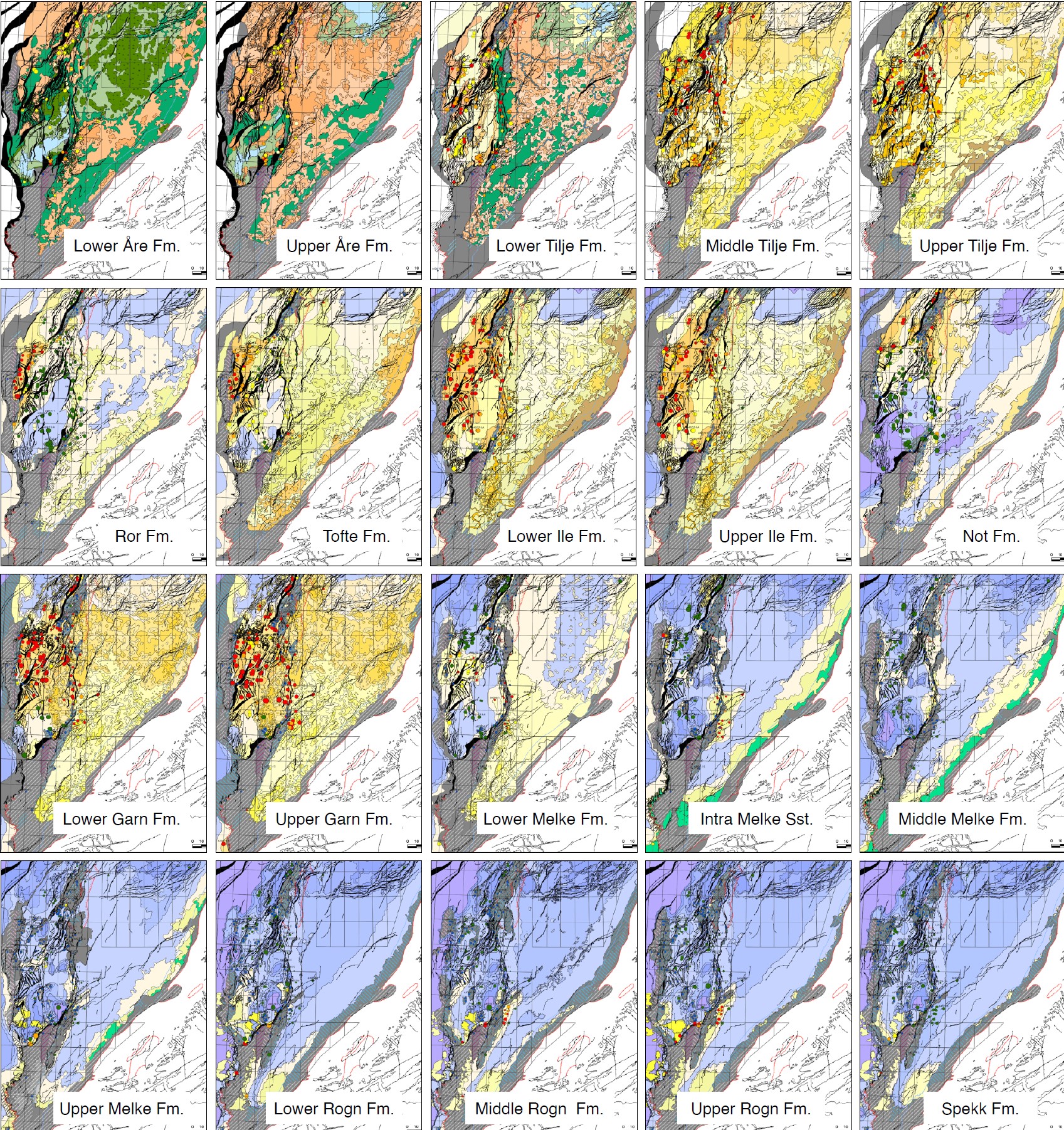
A regional work was performed on Jurassic stratigraphic interval and led to the creation, updating and homogenisation of the complete series of Depositional Environment Maps (DEM). The review and integration of biostratigraphic data, well correlations, seismic interpretation and seismic-well tie was necessary to understand the overall pattern of Jurassic deposition in the Norwegian Sea. 20 paleogeographic maps are now available, from Hettangian with the Åre formation to Berriasian with the Spekk formation, covering Trøndelag Platform, Halten Terrace, Dønna Terrace and Nordland Ridge.